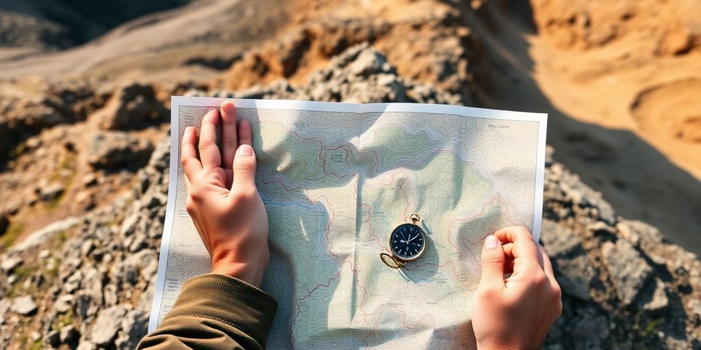
Hey there, fellow adventurers! Ready to hit the trails? Before you lace up those boots, let's talk about something super important: trail map resources. Gone are the days of just a paper map and a compass (though those are still cool to have!). Now, there are so many awesome tools out there to help you find your way, stay safe, and even discover new spots. We're going to check out some of the best ways to use these trail map resources to make your next outdoor trip the best one yet.
Key Takeaways
- Digital maps help you find routes and stay updated in real-time.
- Mobile apps let you use maps offline and get accurate GPS info.
- Community platforms offer tips and local insights from other hikers.
- Good gear, like portable chargers, makes sure your map tools work when you need them.
- Advanced features help you plan custom routes and track your progress for safety.
Unlocking Your Adventure with Digital Trail Map Resources
Finding Your Perfect Path with Online Maps
So, you're itching to hit the trails? Awesome! One of the coolest things about planning a hike these days is how easy it is to find maps online. Seriously, it's a game-changer. You can use sites like AllTrails or even Google Maps to scout out potential routes. These platforms let you see the trail's elevation, length, and even photos from other hikers. It's like having a virtual tour guide before you even lace up your boots. Plus, you can filter by difficulty, distance, and features like waterfalls or viewpoints. It's all about finding that perfect match for your skill level and what you want to see.
Navigating New Terrains with Confidence
Ever felt that little flutter of anxiety when heading into unfamiliar territory? Yeah, me too. That's where digital trail maps really shine. They give you the confidence to explore new places without getting hopelessly lost. Many apps offer detailed topographic maps that show you the lay of the land. This means you can anticipate changes in elevation, spot potential hazards, and generally get a better feel for the terrain. Think of it as having a super-powered compass and map all rolled into one. With a good digital map, you can focus on enjoying the scenery instead of worrying about [hiking apps](#1af6].
Real-Time Updates for Safer Journeys
Okay, this is where things get seriously cool. Digital trail maps aren't just static images; they're often updated in real-time with info from other hikers. This means you can get the scoop on trail conditions, recent wildlife sightings, or even temporary closures. Imagine knowing about a washed-out bridge before you get there! It's like having a network of fellow adventurers looking out for you. Plus, many apps let you report your own observations, so you can contribute to the community and help keep everyone safe. It's all about making informed decisions and staying prepared for whatever the trail throws your way.
Having access to real-time updates can seriously impact your safety and enjoyment on the trail. It's not just about knowing where to go, but also about knowing what to expect when you get there. This kind of information can help you adjust your plans, pack accordingly, and avoid potential hazards.
Here's a quick rundown of the benefits:
- Up-to-date trail conditions
- Wildlife alerts
- Temporary closure notifications
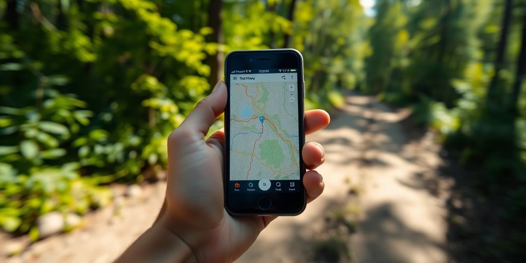
Embracing the Power of Mobile Trail Map Resources
Mobile trail maps are a game-changer, seriously. Remember the days of unfolding giant paper maps that would rip in the wind? Yeah, those are pretty much over. Now, you can have detailed maps right in your pocket. It's like having a personal guide with you at all times. Let's look at some reasons why mobile trail maps are so awesome.
Offline Access for Remote Adventures
One of the biggest perks? Offline access. You know how it is – you get out on the trail, and BAM, no signal. With mobile trail maps, you can download the maps beforehand and still see where you are, even without service. It's super useful for those really remote spots where you're trying to get away from it all. I always download a few different sections of the trail, just in case. It's saved me more than once!
GPS Integration for Pinpoint Accuracy
GPS integration is another huge win. These apps use your phone's GPS to show exactly where you are on the map. No more guessing if you're on the right path. It's especially helpful when trails aren't marked well, or when you're trying to find a specific landmark. Plus, you can track your progress and see how far you've gone. It's pretty motivating to see yourself getting closer to your goal. You can compare hiking apps to see which one has the best GPS.
User-Friendly Interfaces for Easy Exploration
Let's be real, nobody wants to struggle with a complicated app when they're out in nature. Luckily, most mobile trail map apps have really user-friendly interfaces. They're designed to be easy to use, even with gloves on or in bright sunlight. You can zoom in and out, search for specific locations, and customize the map to show the information that's most important to you. It makes exploring so much more enjoyable.
I remember one time I was hiking in the mountains, and a storm rolled in out of nowhere. I pulled out my phone, opened my trail map app, and quickly found the nearest shelter. Without that app, I would have been totally lost and probably soaked to the bone. It's not just about convenience; it's about safety too.
Discovering Community-Driven Trail Map Resources
Sharing Insights on Trail Conditions
Ever wonder if that trail you're planning to hike is actually as easy as it looks on the map? That's where the power of community comes in! Lots of trail map resources now let hikers share real-time updates on trail conditions. Think of it as crowd-sourced intel for your outdoor adventures. You can find out about everything from muddy patches and fallen trees to recent wildlife sightings. It's like having a bunch of experienced hikers giving tips right in your pocket. This helps you prepare better and stay safe out there.
Connecting with Fellow Explorers
Trail map resources aren't just about maps; they're about connecting with people who love the outdoors as much as you do. Many platforms have forums or comment sections where you can chat with other hikers, ask questions, and even find hiking buddies. It's a great way to build a community around your shared passion for exploring new places.
Finding Hidden Gems from Local Guides
Tired of the same old tourist traps? Community-driven trail maps can help you discover hidden gems that you won't find in any guidebook. Local hikers often share their favorite off-the-beaten-path trails, scenic viewpoints, and secret swimming holes. It's like getting insider access to the best-kept secrets of the hiking world.
I love using community-driven trail maps because they give me a sense of connection to other hikers. It's reassuring to know that there are people out there who are willing to share their knowledge and experiences to help others have a safe and enjoyable time on the trails.
Essential Gear for Optimizing Your Trail Map Resources
Alright, so you're all set with your digital trail maps, ready to hit the trails. But hold up! Having the right gear can seriously boost your map-reading experience and keep you powered up. Let's talk about some must-haves.
Portable Chargers for Extended Use
Okay, this one's a no-brainer. Your phone's battery is your lifeline when using digital maps, and there's nothing worse than seeing that dreaded low-battery warning when you're miles from civilization. I always bring at least one, if not two, portable chargers. Think about it: GPS drains power fast, especially if you're using your screen a lot. Get a high-capacity power bank; you won't regret it. I've been saved by mine more times than I can count. Consider solar chargers for longer trips, too!
Protective Cases for All Weather
Your phone is your map, your camera, and your connection to the outside world. Don't let a little rain or a clumsy drop ruin your trip! A rugged, waterproof case is key. I'm talking about the kind that can handle being submerged in water (within reason, of course) and survive a fall onto rocks. Look for cases with good grip, too, so they don't slip out of your hands easily. I once saw a guy drop his phone in a stream, and let's just say his hiking trip ended abruptly. Learn from his mistake!
Mounts for Hands-Free Navigation
Tired of constantly pulling your phone out of your pocket? A mount can be a game-changer. Whether it's a handlebar mount for your bike or a chest mount for hiking, having your map visible and accessible without using your hands is super convenient. Plus, it's safer! No more fumbling with your phone while trying to navigate tricky terrain. I personally love using a Tour Divide bikepacking adventure handlebar mount when I'm cycling; it keeps my map right in my line of sight.
Investing in these simple pieces of gear can make a huge difference in your overall trail experience. It's all about being prepared and making your adventure as smooth and enjoyable as possible. Happy trails!
Planning Your Next Journey with Advanced Trail Map Resources
Customizing Routes to Your Skill Level
Planning a hike? Awesome! One of the coolest things about today's trail map resources is how easily you can tailor a route to your specific abilities. No more accidentally signing up for a climb that's way beyond your current fitness. Most apps let you filter trails by difficulty, elevation gain, and even trail type (like loop versus out-and-back). This means you can find something that's challenging but still enjoyable. I remember one time I didn't do this and ended up crawling up a mountain – not fun! Now, I always check the Bruce Trail App before heading out.
Estimating Time and Distance Accurately
Gone are the days of guessing how long a hike will take. Advanced trail maps use algorithms to give you pretty accurate estimates of time and distance. They factor in things like elevation changes and average hiking speeds. This is super helpful for planning your day, especially if you're trying to catch the sunset or have other commitments. Plus, knowing the distance helps you pack the right amount of water and snacks. Nobody wants to run out of energy halfway through! Accurate time estimates are a game-changer for safety and enjoyment.
Identifying Points of Interest Along the Way
Trail maps aren't just about getting from point A to point B; they're about the journey! Many resources now highlight points of interest along the trail. Think scenic overlooks, waterfalls, historical markers, or unique geological formations. This adds a whole new layer to your hiking experience. It's like having a virtual tour guide in your pocket. I love discovering hidden gems I never knew existed.
It's amazing how much more enjoyable a hike can be when you know what to expect and what to look forward to. Take the time to plan, and you'll have a much better experience.
Here's a quick example of how planning can help:
- Beginner Hiker: Choose a trail under 3 miles with minimal elevation gain.
- Intermediate Hiker: Opt for a 5-10 mile trail with moderate elevation changes.
- Advanced Hiker: Tackle a 10+ mile trail with significant elevation gain and technical sections.
Staying Safe with Smart Trail Map Resources
Emergency Features for Peace of Mind
It's always a good idea to be prepared, right? Many trail map apps now come with built-in emergency features. Think of it as a safety net in your pocket. Some apps let you send your exact location to emergency contacts with a single tap. Others have an SOS function that connects you directly to local services, which can be a lifesaver if you're in a bind. Knowing these features are there can really boost your confidence when you're out exploring. It's like having a digital guardian angel!
Weather Overlays for Preparedness
Weather can change in a heartbeat, especially in the mountains. That's why weather overlays on trail maps are super useful. You can see real-time radar, temperature changes, and even wind speeds right on your map. This helps you make smart decisions about whether to push on, turn back, or find shelter. I always check the weather before heading out, but having that info readily available on the trail is a game-changer. It's all about being proactive and avoiding surprises.
Tracking Your Progress for Accountability
Ever get that feeling you're not sure if you're on the right track? Trail map apps can help with that too! Many have a tracking feature that records your route as you hike. This is great for a few reasons. First, you can see exactly where you've been, which helps you stay oriented. Second, if you do get lost, you can easily retrace your steps. Third, it's fun to look back at your hiking blog and see how far you've come! It's like leaving a digital breadcrumb trail, ensuring you're always accountable for your progress and safety.
It's important to remember that while these digital tools are amazing, they're not foolproof. Always carry a physical map and compass as a backup, and make sure you know how to use them. Batteries die, signals get lost, and technology can fail. Being prepared with traditional navigation skills is just as important as having the latest app.
Beyond the Basics: Creative Uses for Trail Map Resources
Documenting Your Adventures with Geotagging
Ever wish you could remember exactly where that amazing view was? Geotagging is your answer! It's like leaving digital breadcrumbs on your journey. By adding location data to your photos, you can easily revisit your favorite spots and share them with others. It's a fantastic way to keep a visual record of your hikes and create a personal archive of your outdoor experiences. Plus, it makes it super easy to find those spots again next time!
Creating Personalized Hiking Journals
Why just hike when you can tell a story? Use your trail map data to create a personalized hiking journal. Combine your geotagged photos with notes about the trail conditions, wildlife sightings, and memorable moments. Think of it as your own adventure log! You can use apps or even a simple document to compile your experiences. It's a great way to reflect on your journeys and share them with friends and family. You can even track your progress over time. Consider including:
- Date and time of hike
- Trail conditions
- Wildlife sightings
- Personal reflections
Sharing Your Favorite Trails with Friends
Found an awesome trail that everyone needs to know about? Share it! Trail map resources make it easy to share your favorite routes with friends. You can export your tracked data and send it to them, or even create a public profile where you share your adventures. It's a great way to inspire others to get outdoors and explore. Plus, you might even discover new trails from your friends in return! Sharing is caring, especially when it comes to amazing hiking spots. You can use Trail Explorer app to find new trails.
Sharing your trail experiences not only connects you with fellow outdoor enthusiasts but also helps build a community around responsible exploration and conservation. It's a win-win for everyone involved!
Ready for Your Next Big Trip?
So, there you have it! Getting ready for a trail adventure doesn't have to be hard. With the right maps and a little bit of planning, you'll be all set to hit those trails with confidence. Remember, every trip is a chance to see new things and make cool memories. So grab your maps, pack your bag, and get out there. The outdoors is waiting for you, and it's going to be awesome!
Frequently Asked Questions
How do digital trail maps help me find my way?
Digital maps are super helpful for finding your way around. They show you where trails are, how long they are, and even how much they go up and down. Some apps can even tell you if a trail is closed or has problems in real-time.
What's so great about using mobile trail maps?
Mobile trail maps are awesome because you can use them even when you don't have internet. They use your phone's GPS to show you exactly where you are on the trail. Plus, they're usually easy to use, so anyone can figure them out.
How can community-driven trail maps make my trip better?
Community maps are made by other hikers like you! People share tips about trail conditions, cool spots they found, and even warnings about tricky areas. It's like having a bunch of friends helping you plan your hike.
What extra stuff do I need to use trail maps well?
To get the most out of your map apps, bring a portable charger so your phone doesn't die. A strong case will protect your phone from bumps and bad weather. And a mount can hold your phone so you can see the map without holding it.
How do advanced trail map features help me plan my hikes?
Advanced map tools let you pick trails that are just right for your fitness level. They can guess how long it will take you to finish a trail and how far it is. They also point out interesting things to see along the way, like viewpoints or waterfalls.
What safety features do modern trail maps offer?
Smart maps have special features to keep you safe. Some can send out an emergency signal if you get lost or hurt. They can also show you the weather forecast so you're ready for anything. And they can track your progress, which is good for staying on track and for sharing your adventure later.